While Attending Bemidji State…

I attented a variety of courses that have allowed me to learn about GIS and Natural Resource Management seperately and how those two subjects can be utilized together. Project Links:
The projects completed during my time at Bemidji State University were depreciated after my graduation. I have static images of some of the projects completed.
Project:
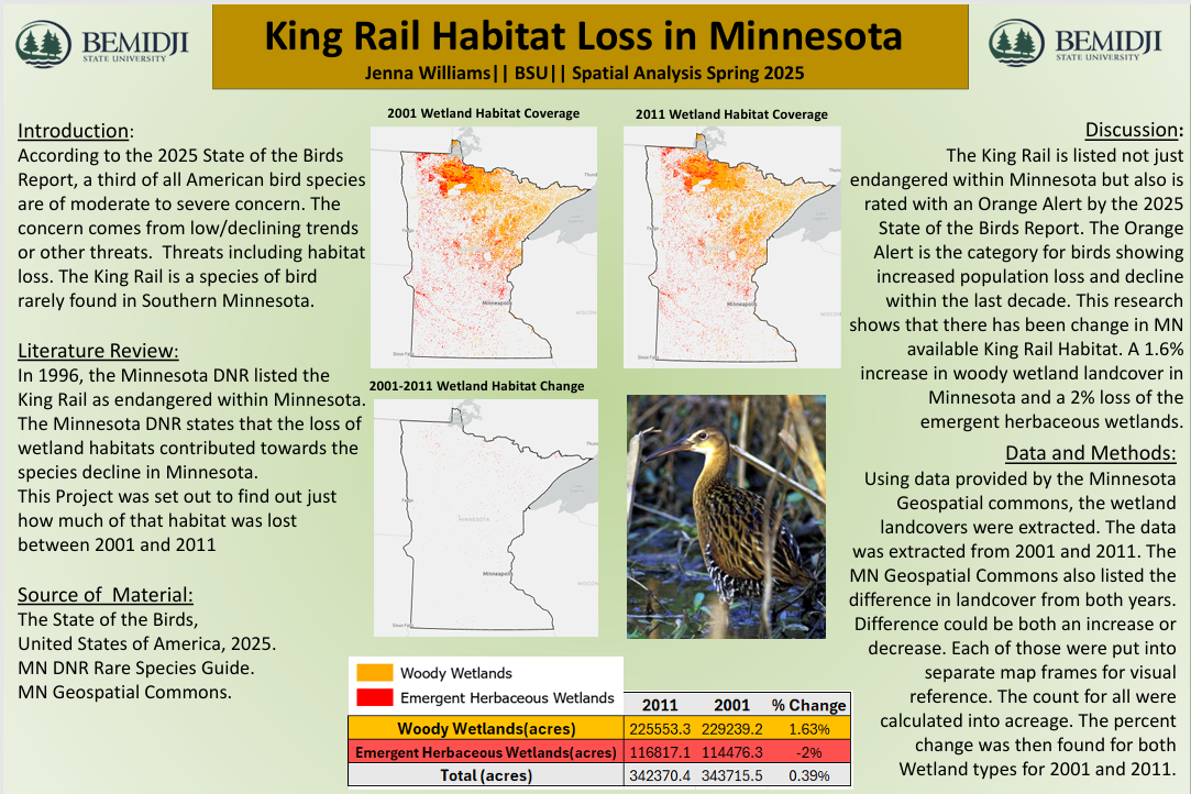
The King Rail Habitat Loss project was a way for me to combine geospatial proccesses and my knowlegde of King Rails behaviors and habitat preference.
Skills Learned During Project:
Aquiring publically available data, storing and processing it correctly.
Analysis of two seperate data sets individually and comparatively.
Use of geospatial proccessing tools in relation to the King Rail habitat analysis and its connection to potential population decline.
Project Links:
The projects completed during my time at Bemidji State University were depreciated after my graduation. I have static images of some of the projects completed.
Project:
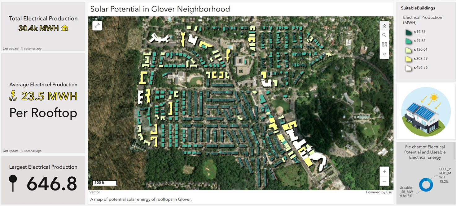
The Solar Potential project is an ESRI Dashboard visualizing roof-top solar power potential in Glover Vermont.
Skills Learned During Project:
Use of DEM in Spatial Analysis.
Building a Dashboard to display spatial information in an accesssable way to a wide variety of audiences.
Project Links:
The projects completed during my time at Bemidji State University were depreciated after my graduation. I have static images of some of the projects completed.
Project:
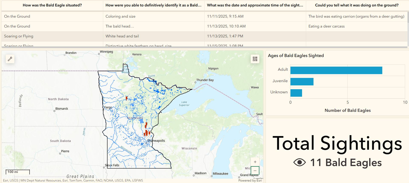
An ESRI Dashboard containing information gathered through a Survey123 sent out to my aquaintences.
Skills Learned During Project:
Creation of a Survey123 project.
Creating a Dashboard that is connected to the results of the Survey123 to display active updates based on the responses.
Project Links:
The projects completed during my time at Bemidji State University were depreciated after my graduation. I have static images of some of the projects completed.
Project:
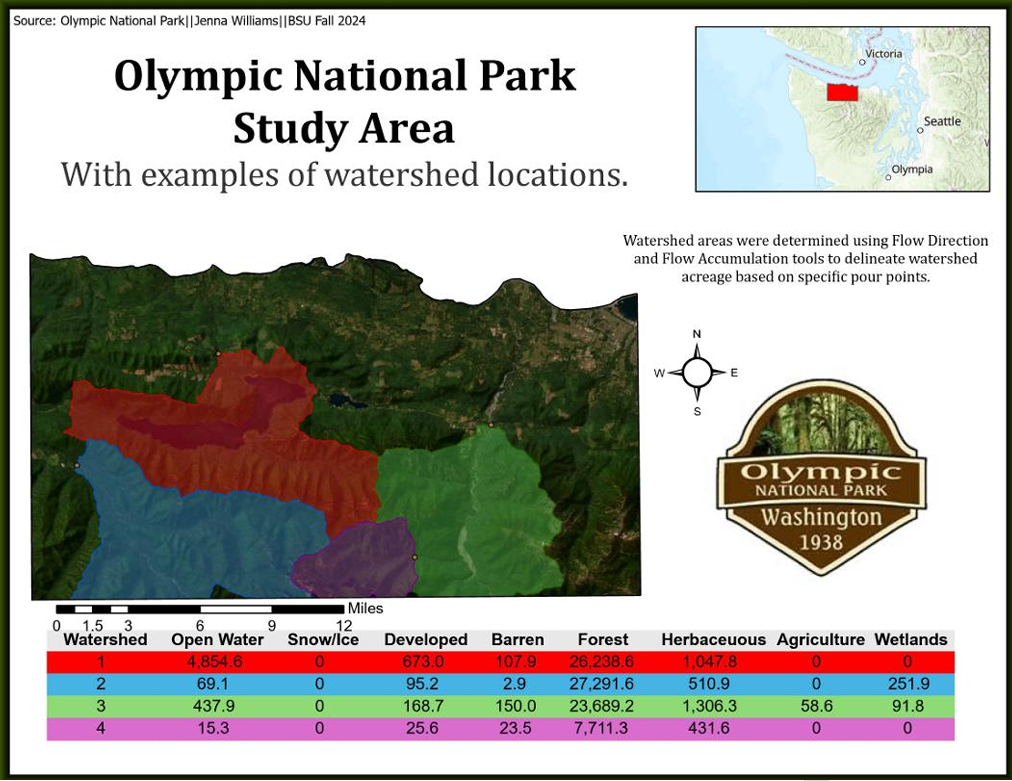
A layout containing information on the watershed locations within Olympic National Park.
Skills Learned During Project:
Analyzing an area with the Flow Direction and Flow Accumulation tools within ArcGIS Pro based on pour points.